Electronics Cartography
()Sort by
-

Garmin Veu452S-Adriatic Sea North Coast Card Marine Charts
213.99 €
-
Navionics Navionics+ Small SD Fehmarn to Swinoujscie Map
148.99 €
-

Navionics MSD Regular EU015R Mar Egeo Mar MárMara Chart
187.16 €
-

Navionics NAEU643L - Mediterranean And Black Sea EU643L - Large Map
286.61 €
-

C-map 4D Max+ Local New Caledonia Map
133 €
-

Garmin Northwest Portugal+Spain Navionics+™ Marine Charts
139.99 €
-

Garmin NAEU649L Norway Navionics®+ Micro SD/SD Card Map
250 €
-

Garmin Mediterranean Coast Spain Navionics+™ Marine Charts
136 €
-

Garmin NAEU014R Italy/Adriatic Sea Navionics®+ MicroSD™/SD™ Card Marine Charts
143.99 €
-
Plastimo Cavalaire-Saint Raphaël Marine Chart
25.49 €
-
Plastimo Saint Raphaël-Nice-Lérins Islands Marine Chart
25.49 €
-

Humminbird Autochart N Map
208 €
-

Navionics Platinum+ XL3 CF US NorthEast Canyons Map
239.99 €
-

Navionics Navionics+ Small Southeast of Sweden Map
205.99 €
-

Navionics Navionics+ Small SD Mallorca and Menorca Map
148.99 €
-
Navionics Navionics+ Small Tosen to Namsos Map
143.49 €
-
Navionics Navionics+ Small SD Samandagi to Manavgat Map
148.99 €
-
Navionics Navionics+ Small SD Northeast of Greece Map
149.49 €
-
Navionics Navionics+ Small SD Alassio Port San Luis Map
148.99 €
-
Navionics Navionics+ Small SD Bercelona to Benidorm Map
149.49 €
-
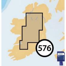
Navionics Navionics+ Small SD Shannon to Erne Map
148.99 €
-

Navionics Navionics+ Small SD Klaholmen to Rekefjord Map
148.99 €
-
Navionics Navionics+ Small Nouadhibou To Abidjan Map
205.99 €
-
Navionics Platinum+ XL Mediterranean South West Refurbished
153.99 €
-
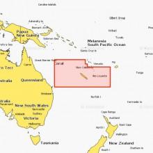
Navionics Navionics+ Small New Caledonia Map
205.99 €
-
Navionics Navionics+ Small CF Fehmarn to Swinoujscie Map
205.99 €
-
Navionics Navionics+ Small Cf West of Sweden Map
205.99 €
-
Navionics Navionics+ Small CF North of Aegean Sea Map
205.99 €
-
Navionics Navionics+ Small CF Barcelona Map
205.99 €
-
Navionics Navionics+ Small Voersaa Fehmarn Map
205.99 €
-

C-map North-West European Coasts Map
208.99 €
-

C-map 4D MAX+ WIDE UK Ireland and The Channel Map
212.99 €
-

C-map 4D Max Local Acapulco to Mazatlan Map
93.99 €
-

C-map 4D Max Local Hawaii Islands Map
101.99 €
-

C-map 4D Max+ Local San Juan Islands to Nigei Island Map
101.99 €
-

C-map Central and West Europe Discover X Card
200.99 €
-

C-map United Kingdom Reveal Card
212.99 €
-

C-map North America map
113.99 €
-

Garmin Mediterranean+Black Sea Navionics Vision+™ Marine Charts
282.99 €
-

Garmin NAEU646L Europe/Central&West Navionics®+ Micro SD/SD Card Map
203.99 €
-

Garmin Bay Of Biscay Navionics Vision+™ Marine Charts
225.49 €
-

Garmin Central&West Europe Navionics Vision+™ Marine Charts
282.99 €
-

Garmin Central&West Mediterranean Sea Navionics+™ Marine Charts
136 €
-

Garmin Central&West Mediterranean Sea Navionics Vision+™ Marine Charts
217.99 €
-

Garmin Italy Adratic Sea 010-C1239-20 Navionics+™ Marine Charts
139.49 €
-

Garmin Italy Adratic Sea Navionics Vision+™ Marine Charts
217.99 €
-

Garmin Mediterranean Coast Spain Navionics Vision+™ Marine Charts
212.99 €
-

Garmin Mediterranean Sea Southeast Navionics Vision+™ Marine Charts
212.99 €
-

Garmin Sweden Southeast Navionics+™ Marine Charts
129.49 €
-

Garmin NAEU012R Mediterranean Sea Central&West Navionics®+ MicroSD™/SD™ Card Marine Charts
136 €
-

Garmin NAEU644L Baltic Sea Navionics®+ MicroSD™/SD™ Card Marine Charts
234.49 €
-

Garmin NPEU012R Mediterranean Sea Central&West Navionics Platinum+™ MicroSD™/SD™ Card Marine Charts
203.99 €
-

Garmin EU723L Mar Mediterraneo Marine Charts
391.99 €
-

Garmin Mar Tirreno Regular Marine Charts
261.49 €
-

Garmin NAEU008R Bay of Biscay Navionics®+ Micro SD/SD Card Map
148.99 €
-

Garmin NAEU073R Italy/Lakes&Rivers Navionics®+ Micro SD/SD Card Map
156.49 €
-

Garmin NAEU643L Mediterranean&Black Sea Navionics®+ Micro SD/SD Card Map
203.99 €
-

Garmin NPEU009R Portugal&Spain/Northwest Navionics®+ Micro SD/SD Card Map
203.99 €
-

Garmin NAAF004R Africa/Northwest Navionics®+ MicroSD™/SD™ Card Marine Charts
203.99 €
-

Garmin NPEU015R Aegean Sea/Sea of Marmara Navionics®+ MicroSD™/SD™ Card Marine Charts
212.99 €
-

Garmin Mediterranean+Black Sea Navionics+™ Marine Charts
350 €
-

Garmin NAEU004R Irish Sea Navionics®+ Micro SD/SD Card Map
187.16 €
-

Garmin NAEU066R Alpine/Lakes&Rivers Navionics®+ Micro SD/SD Card Map
187.16 €
-

Garmin Bay Of Biscay Navionics+™ Marine Charts
139.99 €
-

Garmin NAEU010R Spain/Mediterranean Coast Navionics®+ Micro SD/SD Card Map
148.99 €
-

Garmin NPEU008R Bay of Biscay Navionics Platinum+™ MicroSD™/SD™ Card Marine Charts
203.99 €
-

Garmin NPEU073R Italy Lakes&Rivers Navionics Platinum+™ MicroSD™/SD™ Card Marine Charts
240.99 €
-

Garmin NAEU009R Portugal&Spain/Northwest Navionics®+ Micro SD/SD Card Map
148.99 €
-

Garmin NAEU628L U.K/Ireland&Holland Navionics®+ Micro SD/SD Card Map
234 €
-

Garmin Black Sea+Azov Sea Navionics+™ Marine Charts
143.99 €
-

Garmin Mediterranean+Black Sea Navionics+™ Marine Charts
206.99 €
-

Garmin Northwest Portugal+Spain Navionics Vision+™ Marine Charts
225.49 €
-

Garmin NAEU015R Aegean Sea/Sea Of Marmara Navionics®+ microSD™/SD™ Card Map
146.99 €
-

Garmin NPEU016R Mediterranean Sea. Southeast. Navionics Platinum+™ microSD™/SD™ Card Map
203.99 €
-

Plastimo Calvi-Bastia Marine Chart
25.49 €
-

Plastimo La Rochelle-Oléron Island Marine Chart
25.49 €
-

Plastimo Port Saint Louis-Marseilles-Etang de Berre Marine Chart
25.49 €
-

Plastimo Saint Tropez Marine Chart
9.99 €
-
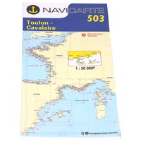
Plastimo Toulon-Cavalaire-Hyères Islands Marine Chart
25.49 €
-

Plastimo Nice-San Remo Marine Charts
24.99 €
-
Plastimo Denia-Santa Paola Marine Charts
24.99 €
-

Plastimo Baleares Islands Marine Chart
22.99 €
-

Plastimo Barcelona-Tarragona Marine Chart
24.99 €
-

Plastimo Bay of Arcachon-Royan-Cap Breton Marine Chart
29.99 €
-
Plastimo Marseilles-San Remo Marine Chart
7.99 €
-
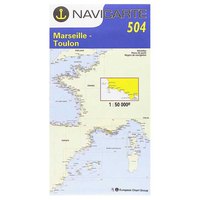
Plastimo Marseilles-Toulon-Les Calanques Marine Chart
24.99 €
-

Plastimo Gulf of Lions-Marseilles-Barcelona Marine Chart
7.99 €
-
Plastimo Marseilles Marine Chart
8.99 €
-

Plastimo Ré Island Marine Chart
9.99 €
-

Plastimo Western Mediterranean Sea Marine Chart
27.99 €
-
Raymarine LightHouse SD 32Gb Preloaded Mediterranean Chart
205.49 €
-
Raymarine LightHouse SD 32Gb Preloaded Northern Europe Chart
205.49 €
-

Raymarine LightHouse SD 32Gb Preloaded Western Europe Chart
205.49 €
-

Oem Marine Log Book
29.99 €
-

Humminbird Autochart Zline SD EU Nautical Chart
119.99 €
-

Humminbird Pantano Garcia Sola SD Cartridge
72.99 €
What is a nautical chart?
Cartography:Cartography plays a crucial role in the creation and use of nautical charts. Cartography uses precise survey data to accurately represent the shape, contours, and characteristics of the land sea interface.
Nautical Chart:
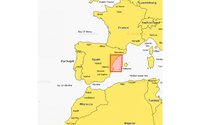
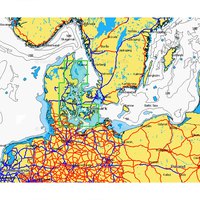
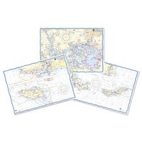
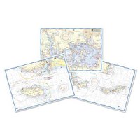
Nautical charts are specialized maps designed for navigation in marine environments. They provide detailed information about water depths, coastline features, navigational aids, and hazards. You can buy nautical charts from Garmin, Humminbird, B&G, Navionics, and C map.
A nautical chart, also known as a marine chart or sea chart, is a specialized map used by mariners for navigation and safe passage at sea. It provides detailed information about the coastal areas, waterways, depths, and hazards in a specific maritime region. Nautical charts are essential tools for sailors, fishermen, and other maritime professionals to navigate safely and efficiently.
Nautical charts are typically produced by national hydrographic offices or other authorized agencies. They are created using accurate surveying techniques, including depth soundings, shoreline measurements, and data from satellite and aerial surveys. The information is then compiled and presented on the chart in a standardized manner.
These indicate the water depths at specific locations, allowing mariners to assess whether their vessel can safely navigate in a particular area.
The chart shows the shape and features of the coastline, including landmarks, lighthouses, and other prominent structures. These visual references help mariners identify their position and make accurate navigation decisions.
Nautical charts depict buoys, beacons, and other navigational aids that assist mariners in determining their position and following established shipping routes.


